
Venezuela vs. Guyana: Military Tensions Escalate Over Oil-Rich Waters!
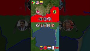
The long-standing territorial dispute between Venezuela and Guyana has flared up once again! A Venezuelan naval vessel has reportedly entered the contested Essequibo region, sparking fresh concerns over sovereignty and control of oil-rich waters.
The ExxonMobil oil drilling operations in the area have further fueled tensions, with Guyanese President Irfaan Ali accusing Venezuela of aggression. Meanwhile, the Maduro government denies the incursion, calling Guyana’s claims a provocation.
With geopolitical tensions rising and the United States closely monitoring the situation, will this dispute lead to a serious military conflict? And how will the International Court of Justice handle this escalating crisis?
🇻🇪⚡ Venezuela vs. Guyana: Military Tensions Escalate Over Oil-Rich Waters! 🇬🇾⚡
🔴 Watch now for the latest updates on this high-stakes standoff in South America!
💬 What do you think? Will this conflict escalate further, or can diplomacy prevent a showdown? Drop your thoughts in the comments!
📌 #VenezuelaGuyanaConflict #EssequiboRegionDispute #SouthAmericaGeopolitics #OilExplorationConflicts #ExxonMobilOilDrilling #CaribbeanGeopoliticalTensions #VenezuelanNavalActivities #GuyanaSovereigntyIssues #InternationalCourtOfJustice #LatinAmericaNews
source
About The Author


Venezuela already has the Largest proven Oil Reserves in the World.What Maduro want with Guyana Oil?He only spoiling for trouble and he going to get it . Hr wants to Showoff his Army to We small Countries but is not our Armies will fight him,he will have to deal with Washington.
Venezuelan in Guyana:100000
Guyanese in Venezuela:0
❤❤😂
Big brother ain’t gonna fight this one for you
Really, mad ura wasn't even born when that agreement was made. Further more this is the aboriginal copper colored arawak people land so called African shit.
The American military is here and well equipped to deter these greedy people
Brazil would give some assistance as well
This man is nothing like Chavez he Mussy rolling in his grave to see what Happen to his country 😮
These people are shameless. Essiquibo is part of Guyana for decades. The dictator can’t take care of his own country and his own country oil. He wants Guyana oil . Greedy.
"### La Guayana Esequiba es de Venezuela – Un Análisis Histórico, Jurídico y Geopolítico
La **Guayana Esequiba**, una región de 159,542 km² al oeste del río Esequibo, es objeto de una disputa territorial entre Venezuela y Guyana. Este territorio, rico en recursos naturales, fue usurpado por el Reino Unido mediante el **Laudo Arbitral de París de 1899**, un fallo que Venezuela considera nulo e írrito. A lo largo de la historia, los mapas trazados por Robert Hermann Schomburgk y las acciones británicas han mostrado contradicciones y ambiciones expansionistas que violaron acuerdos históricos como el Tratado de Münster (1648). Este documento busca demostrar que la Guayana Esequiba pertenece legítimamente a Venezuela, basándose en argumentos históricos, jurídicos y geopolíticos.
—
## *1. Argumentos Históricos*
### *1.1. Pertenencia Original al Imperio Español*
– La Guayana Esequiba formó parte de la *Capitanía General de Venezuela* desde su creación en 1777.
– Tras la independencia en 1811 y la disolución de la Gran Colombia en 1830, el río Esequibo quedó reconocido como el límite natural entre Venezuela y la Guayana Holandesa (actual Guyana).
### *1.2. Tratado de Münster (1648)*
– España reconoció los asentamientos holandeses al este del río Esequibo, mientras que los territorios al oeste permanecieron bajo soberanía española.
– La ocupación británica posterior violó este acuerdo al expandir sus pretensiones hacia el oeste tras adquirir la Guayana Holandesa en 1814.
### *1.3. Ambiciones Británicas y Descubrimiento de Oro*
– En el siglo XIX, el descubrimiento de oro en la cuenca del río Yuruari despertó el interés británico por expandir su control territorial hacia áreas ricas en recursos naturales.
– Esta expansión culminó con el trazado arbitrario de la "Línea Schomburgk" en 1840, que sobrepasó ampliamente los límites reconocidos históricamente.
—
## *2. La Usurpación Británica y Contradicciones del Laudo Arbitral*
### *2.1. La Línea Schomburgk*
– Robert Hermann Schomburgk trazó varios mapas entre 1835 y 1844:
– En su primer mapa (1835), reconoció el río Esequibo como límite natural, salvo una pequeña "mordida" en el noreste.
– Posteriormente, amplió arbitrariamente las reclamaciones británicas hacia el oeste, incluyendo áreas del Cuyuní y Yuruari.
– Estas contradicciones reflejan un acto deliberado de expansión territorial sin base jurídica ni histórica.
### *2.2. El Laudo Arbitral de París (1899)*
– El fallo otorgó a Gran Bretaña todo el territorio al oeste del río Esequibo sin justificación válida.
– Venezuela denunció en 1962 que el tribunal arbitral estuvo viciado por irregularidades, incluyendo acuerdos secretos entre Rusia (árbitro) y Gran Bretaña.
– El Acuerdo de Ginebra (1966) reconoció esta denuncia y estableció un marco para resolver pacíficamente la disputa.
—
## *3. Argumentos Jurídicos*
### *3.1. El Acuerdo de Ginebra (1966)*
– Firmado entre Venezuela y el Reino Unido (en representación de Guyana), este acuerdo reconoce explícitamente que Venezuela considera nulo e írrito el Laudo Arbitral.
– Establece mecanismos para encontrar una solución práctica y pacífica a la disputa.
### *3.2. Derecho Internacional*
– Según principios del derecho internacional, un fallo arbitral viciado por irregularidades es nulo.
– Guyana heredó un territorio usurpado por Gran Bretaña, pero no tiene derechos legítimos sobre él.
—
## *4. Importancia Geopolítica y Económica*
### *4.1. Recursos Naturales*
– La región es rica en oro, diamantes, bauxita y petróleo.
– Las recientes exploraciones petroleras en aguas cercanas al Esequibo han intensificado la disputa territorial.
### *4.2. Proyección Estratégica*
– Controlar la Guayana Esequiba permite acceso directo al Océano Atlántico, lo que tiene implicaciones geopolíticas significativas para ambos países.
—
## *5. Conclusión*
La Guayana Esequiba pertenece legítimamente a Venezuela por razones históricas, jurídicas y geopolíticas:
1. Fue parte integral de la Capitanía General de Venezuela desde 1777.
2. Los mapas iniciales reconocían el río Esequibo como límite natural hasta las ambiciones expansionistas británicas.
3. El Laudo Arbitral de 1899 estuvo viciado por irregularidades y fue denunciado como nulo mediante el Acuerdo de Ginebra.
Venezuela debe continuar defendiendo su soberanía sobre este territorio mediante mecanismos pacíficos establecidos en el derecho internacional y reforzar su posición histórica con evidencia documental contundente ante organismos internacionales como la Corte Internacional de Justicia (CIJ)."
"### The Esequibo Region Belongs to Venezuela – A Historical, Legal, and Geopolitical Analysis
The **Esequibo Region**, a territory of 159,542 km² west of the Esequibo River, is the subject of a territorial dispute between Venezuela and Guyana. This resource-rich region was usurped by the United Kingdom through the **Paris Arbitral Award of 1899**, a ruling that Venezuela considers null and void. Throughout history, the maps drawn by Robert Hermann Schomburgk and British actions have shown contradictions and expansionist ambitions that violated historical agreements such as the Treaty of Münster (1648). This document aims to demonstrate that the Esequibo Region legitimately belongs to Venezuela, based on historical, legal, and geopolitical arguments.
—
## *1. Historical Arguments*
### *1.1. Original Belonging to the Spanish Empire*
– The Esequibo Region was part of the *Captaincy General of Venezuela* since its creation in 1777.
– After independence in 1811 and the dissolution of Gran Colombia in 1830, the Esequibo River remained recognized as the natural border between Venezuela and Dutch Guiana (current Guyana).
### *1.2. Treaty of Münster (1648)*
– Spain recognized Dutch settlements east of the Esequibo River, while territories west of the river remained under Spanish sovereignty.
– Subsequent British occupation violated this agreement by expanding its claims westward after acquiring Dutch Guiana in 1814.
### *1.3. British Ambitions and Gold Discovery*
– In the 19th century, gold discoveries in the Yuruari River basin awakened British interest in expanding territorial control.
– This expansion culminated in the arbitrary tracing of the "Schomburgk Line" in 1840, which far exceeded historically recognized boundaries.
—
## *2. British Usurpation and Arbitral Award Contradictions*
### *2.1. The Schomburgk Line*
– Robert Hermann Schomburgk drew several maps between 1835 and 1844:
– His first map (1835) recognized the Esequibo River as a natural border, except for a small "bite" in the northeast.
– Subsequently, he arbitrarily expanded British claims westward, including areas of Cuyuní and Yuruari.
– These contradictions reflect a deliberate act of territorial expansion without legal or historical basis.
### *2.2. The Paris Arbitral Award (1899)*
– The ruling granted Great Britain all territory west of the Esequibo River without valid justification.
– Venezuela denounced in 1962 that the arbitral tribunal was tainted by irregularities, including secret agreements between Russia (arbitrator) and Great Britain.
– The Geneva Agreement (1966) acknowledged this complaint and established a framework for peaceful dispute resolution.
—
## *3. Legal Arguments*
### *3.1. The Geneva Agreement (1966)*
– Signed between Venezuela and the United Kingdom (representing Guyana), this agreement explicitly recognizes Venezuela's position that the Arbitral Award is null and void.
– Establishes mechanisms for finding a practical and peaceful solution to the dispute.
### *3.2. International Law*
– According to international law principles, an arbitral ruling tainted by irregularities is null.
– Guyana inherited a territory usurped by Great Britain but does not have legitimate rights over it.
—
## *4. Geopolitical and Economic Importance*
### *4.1. Natural Resources*
– The region is rich in gold, diamonds, bauxite, and oil.
– Recent offshore oil explorations have intensified the territorial dispute.
### *4.2. Strategic Projection*
– Controlling the Esequibo Region allows direct access to the Atlantic Ocean, with significant geopolitical implications for both countries.
—
## *5. Conclusion*
The Esequibo Region legitimately belongs to Venezuela for historical, legal, and geopolitical reasons:
1. It was an integral part of the Captaincy General of Venezuela since 1777.
2. Initial maps recognized the Esequibo River as a natural border until British expansionist ambitions.
3. The 1899 Arbitral Award was tainted by irregularities and denounced as null through the Geneva Agreement.
Venezuela must continue defending its sovereignty over this territory through peaceful mechanisms established in international law and reinforce its historical position with compelling documentary evidence before international bodies such as the International Court of Justice (ICJ)."
South America Dicator wants more money.